Seismic Soil Analysis: Revolutionizing Agriculture
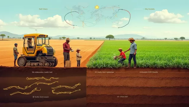
A revolutionary diagnostic technique is poised to transform the agricultural landscape, offering a potential lifeline against looming threats of drought and famine. By adapting technology traditionally reserved for earthquake monitoring and oil exploration, researchers are now tuning into the subtle frequencies of the earth to analyze soil health without breaking ground.
This emerging discipline, dubbed "soilsmology," represents a significant leap forward from conventional testing methods. Historically, understanding soil composition required excavation, a labor-intensive process that ironically destroys the delicate structure researchers aim to study. The Earth Rover programme, a collaborative effort between geophysicists and soil experts, seeks to replace the spade with sound waves, creating a non-invasive, high-definition map of the living world beneath our feet.
The Mechanics of Acoustic Soil Mapping
The methodology is deceptively simple yet highly sophisticated. To assess a plot of land, operators position a metal plate on the surface and strike it with a hammer. This action generates seismic waves that travel through the ground, bouncing off various subterranean features.
The returning signals provide a wealth of data based on how they interact with the underground environment:
- Hard Surfaces: Waves reflect sharply off rocks or compacted subsoil.
- Biological Activity: Signals travel differently through the porous structures created by earthworms and microbial networks.
- Moisture Levels: The speed and behavior of the waves alter based on water saturation, highlighting areas prone to drought or waterlogging.
By interpreting these signals, scientists can generate fine-grained maps that reveal the intricate biological and physical status of the soil, offering insights that surface-level observation simply cannot provide.
Overcoming the Limitations of Traditional Testing
Current agricultural maps are often too broad to be practically useful for individual farmers. Even in well-surveyed nations like the UK, official soil maps often operate on a 5km by 5km grid. This lack of resolution means a map might list a region as having uniform soil, while the reality on the ground—revealed by seismic testing—might uncover over a dozen distinct soil types, including overlooked peat deposits.
For farmers, this lack of precision leads to "blanket interventions." Without detailed data, growers often till entire fields or apply fertilizers uniformly. This approach is not only expensive but can also degrade soil health, harm local wildlife, and contribute to river pollution through runoff.
A Lifeline for Global Food Security
The implications of this technology extend far beyond operational efficiency; they are a matter of survival. With global populations rising and climate instability threatening to reduce crop yields by up to 50% in vulnerable regions, the ability to maximize soil fertility is critical.
Soil experts involved in the project emphasize that soil is a finite and undervalued resource. Since the vast majority of human calories originate from the soil, its degradation through erosion, chemical overuse, and tillage poses an existential threat. In regions like East Africa, where access to professional soil testing labs is limited or logistically impossible for smallholder farmers, this technology could change lives.
The benefits of widespread "soilsmology" adoption include:
- Precision Agriculture: Farmers can identify specific areas of subsoil compaction that restrict root growth and treat only those spots.
- Flood Mitigation: Identifying compacted layers allows for interventions that improve water infiltration, reducing surface runoff and flood risks during rainy seasons.
- Carbon Measurement: The technology offers a more accurate method for calculating soil carbon storage, replacing current estimation methods which involve significant guesswork.
- Yield Optimization: By knowing exactly when to add organic matter or water, farmers can boost productivity without expanding their environmental footprint.
The Future of Farming
The ultimate goal of the initiative is to democratize access to this data. The non-profit organization behind the technology aims to develop a free mobile application. This tool would allow farmers worldwide to measure their soil health independently and receive tailored advice on how to regenerate their land.
Independent experts in soil ecology have welcomed the development, noting that while soil is a complex medium for acoustic analysis, the combination of affordable sensors and advanced data processing could be transformative. As the world faces the dual challenges of feeding a growing population and restoring degraded ecosystems, listening to the earth might just provide the answers we need.